Azimuthal Equidistant Maps
August 14, 2024 - Reading time: 2 minutes
I just had a realization that azimuthal equidistant maps work in radio regardless of where they are centered. this is only possible on a sphere. On a disc that would not be the case because of the ice wall. Radio helps prove globe Earth again.
OK I thought about it more and found this great website:
https://maps.ontarget.cc/azmap/en.html
If we generate a map for Australia, we get this:
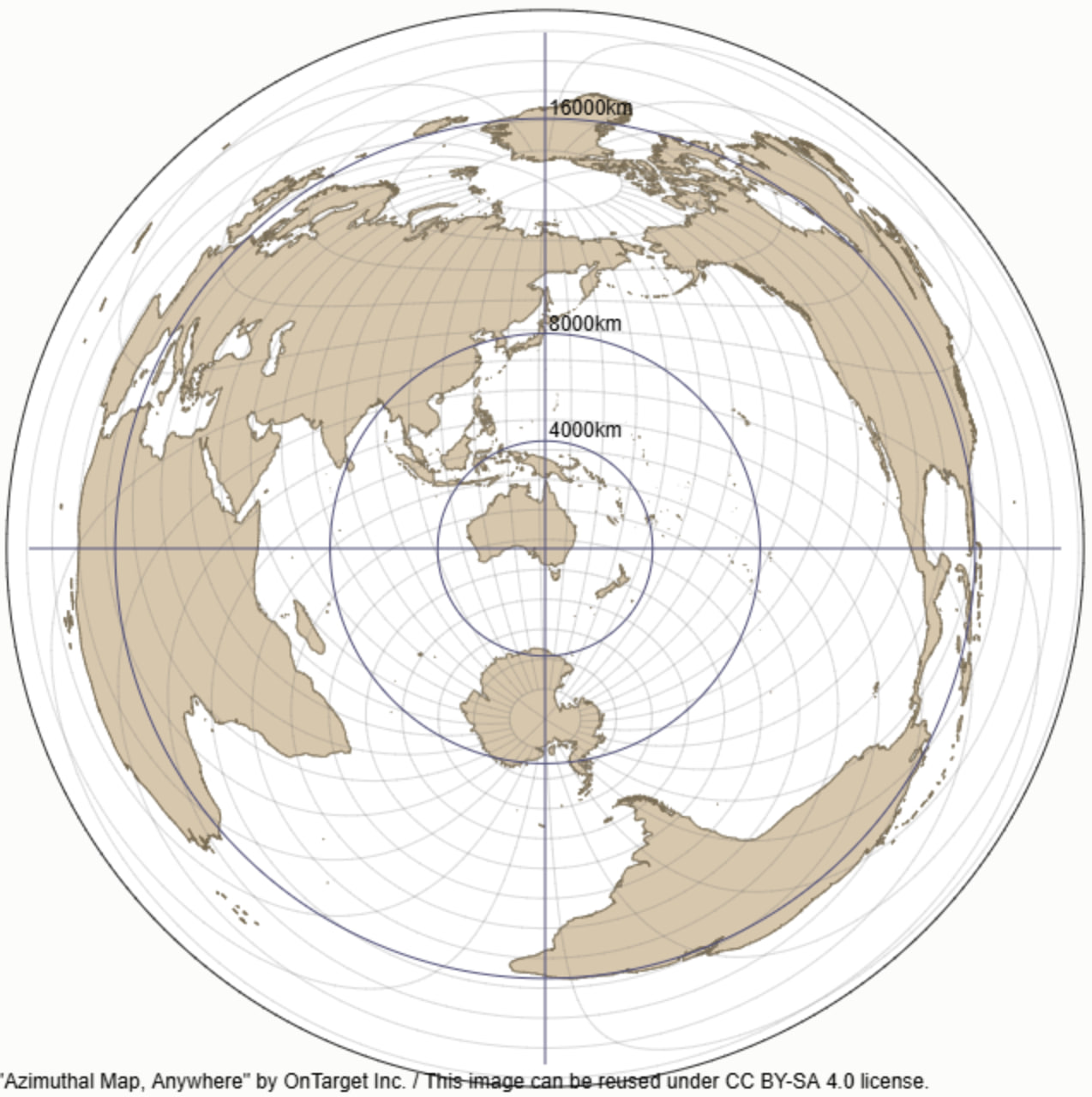
If we can find an Australian with a beam antenna, he will likely have bearings for signals recorded in his logbook. Conversations to Brazil would of course be best if pointed over the southern pole according to this map. We could aggregate all the QSOs between Australia and Brazil with bearing information, and create a map showing it. The radio operators aren't in on anything - it's uncontrolled data from thousands (or tens of thousands) of people. It's just a matter of getting the dataset that's the hard part.
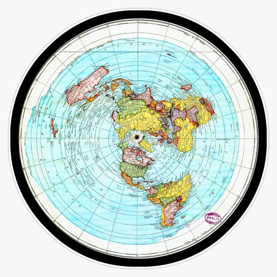
On the disc map, we see that the optimal path is much further and entirely the other way (over the north pole):